
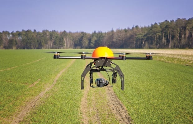
The Department of Posts has for the first time delivered mail using a drone as part of a pilot project in Gujarat’s Kutch district, covering a distance of 46 km in 25 minutes.
The mail was sent by drone from Habay village in Bhuj taluka to Ner village in Bhachau taluka of Kutch district by the postal department under the guidance of the Union Ministry of Communications, a release issued by the Press Information Bureau (PIB) in Ahmedabad said.
“With the success of this pilot project, it will now be possible to make postal deliveries by drone in the future. Keeping pace with modern technology, the Indian Postal Department has successfully tested for the first time in the country’s postal history a pilot project to deliver mail with the help of drone technology in the Kutch district of Gujarat,” the PIB said.
It was a medical parcel, as per the information shared on Twitter by the Union Minister of State for Communications Devusinh Chauhan.
The pilot project specifically studied the cost of delivery by drones and the geographical location between the two centres, as well as possible coordination among staff during the delivery process, including possible roadblocks.
If the experiment is commercially successful, the postal parcel delivery services will be faster.
Chauhan in a tweet on Saturday said, “As the country celebrated the #DroneMahotsav2022, the Department of Posts successfully conducted a pilot test for delivery of parcels through drones in Kutch, Gujarat. The Drone successfully delivered the medicine parcel covering an aerial distance of 46 Km in 30 minutes.”
Usage of drones will increase adoption of Edge computing, in addition to 5G and IoT, industry watchers opine.
Drone usage in India
In India, the use of drones has been gradually rising in various applications, especially in non-commercial applications for aerial cinematography, land surveys, agriculture & mining activities, disaster management, construction activities and mapping national highways and railway tracks, an India Brand Equity Foundation report added.
According to a July 2021 report by BIS Research, the global drone market, which is currently dominated by the US, China and Israel, is estimated to reach US$ 28.47 billion in FY21-22, with India likely to account for 4.25 per cent share.

In India, drones are used in several areas including urban development (The Andhra Pradesh Government is using drones to monitor the development activities of the capital city region, i.e. Amaravati, through drone-based outputs.
Transport (The National Highways Authority of India (NHAI) has deployed drones in the Salem-Chennai green corridor expressway project to ensure accuracy with respect to the extent of land required for the project).
Agriculture (The Maharashtra Government has used drones over fields in the Marathwada region for carrying out crop loss assessments due to deficit rainfall).
Disaster Management (The National Disaster Relief Force used drones in Mandi, Himachal Pradesh, to trace 24 engineering students from Hyderabad who were swept away by the Beas river) and Mining (In Jharkhand, drones are deployed for boundary and safety zone inspection of coal and iron mines, counting of vegetation in reclaimed areas, and profiling of quarry and dump for volume calculations), a PwC report explained.
By connecting drones to the internet, they become part of the cloud infrastructure. Each drone is considered a web server having a set of resources and services to offer. Most drones support Wi-Fi connections; as a result, a drone will have a unique identifier over the Internet.
One of the considerations in integrating drones with the cloud is the distribution of drones and their scalability and ability to offer their services and resources through the APIs, a Hindawi research paper added.
Initiatives of the Government to promote the use of Drones
SVAMITVA Scheme (Survey of villages and mapping with improvised technology in village areas) is an initiative of the Ministry of Panchayati Raj that would ensure the right of rural people to document their respective properties.
The mapping of land is being done using drones and it is being targeted that by March 2025, all the villages across the country shall be covered under the Scheme. The use of technology in a mapping would also ensure a digital database of rural lands if required for future development projects.
Liberalisation in Drone Rules in the year 2021 has ensured that Indian entrepreneurs and start-ups can participate on a global scale in terms of the development of drone technology and its efficient usage.
This is an improvement on the initial set of rules published by the Ministry of Civil Aviation earlier in 2021 which were relatively restrictive. These relaxations could provide the impetus for India to expand technologically and develop into a global drone hub by 2030.
Approval of the Production-Linked Incentive (PLI) Scheme for Drones and Drone Components by the Government is a follow-up to the liberalisation of drone rules.
This will help with the progression of drone technology, which is still in the relatively early stage, by providing incentives to manufacturers.
The scheme has been put into place to incentivise more companies to invest in this technology that could benefit multiple sectors, such as agriculture, mining, infrastructure, surveillance, geo-spatial mapping, healthcare, and others.